
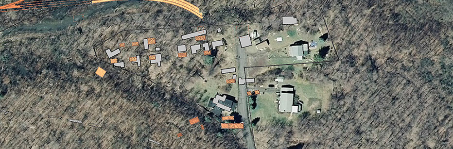
Canal Street (36LU312)
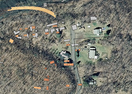
Canal Street is located in the northwest corner of Lattimer No. 1 in a low flat area adjacent to the coal mine workings. In the past, a canal ran parallel to the Northern boundary of the town diverting water from nearby sources for industrial uses such as washing coal. Canal Street, no longer existing, was a short road that ran parallel with the canal a short ways left of the termination of Lower Street in Lattimer. At this intersection a walking bridge ran across the canal providing access for miners to the Slopes and Shafts of Breaker No. 1. For much of its occupation a large culm bank separated a tiny settlement of shanties along Canal Street from the Main Street of Lattimer. On a map from as early as 1878 up to nine structures of varying sizes and shapes can be seen lining the road. Over the course of the following seven decades the structures in this area change shape as additions and outbuildings are added and subtracted in response to the needs of the occupants. Census records and local memory recall the residents of Lower Street as primarily Eastern European, with some Italian. Contrary to some of the other areas around the towns, this demographic diversity is interesting to imagine in the tight confines of this neighborhood. An aerial photo from 1938 shows the small area crisscrossed with fence lines, walking paths and likely completely covered over with gardens, animal pens and outbuildings. Some of the names we have seen associated with the area include: Sebya, Grorizzi, Wassil, Bali, Matz, Novak, Alampa, Rim, Liotti and Verduch.
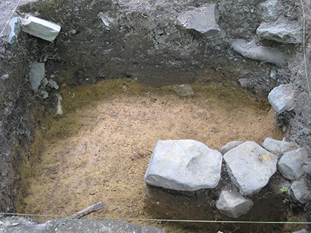
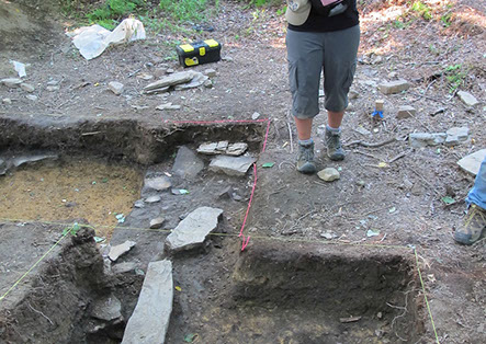
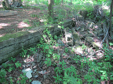
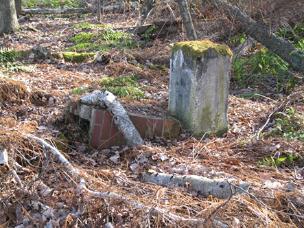
Today the area is owned by Willie and Michelle Vitz, who live in an older house, on the southern end of the neighborhood on Lower Street. The site area is overgrown and all of the structures have been removed, but masonry foundations from a number of buildings are evident to the eye, as are a number of depressions related to building foundations and cellars. Landscaping of the land is also clearly visible, most specifically in a long masonry terrace that runs the length of the road. The crumbling concrete roadbed of Canal Street is also still visible. Some of the most unique features include the remains of two slate ice houses built into the culm banks on the south end of the lots. Cold air trapped between the loosely dumped slate can still be felt drafting out of the base of these structures. The block foundation of a long structure (65 feet long), possibly barracks-like housing, is visible on the northern edge of the roadbed. Different architectural treatments seem to divide this structure into three or four individual living units.
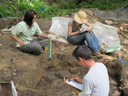
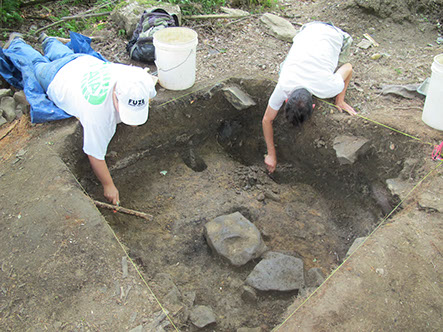
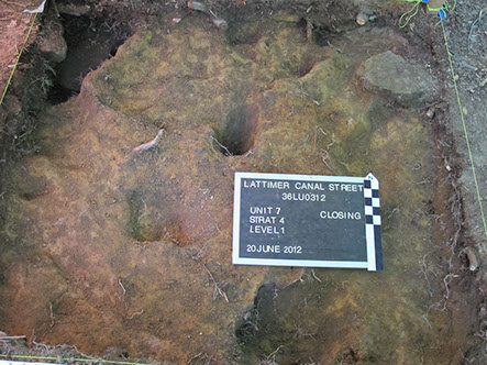
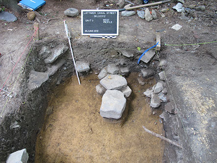
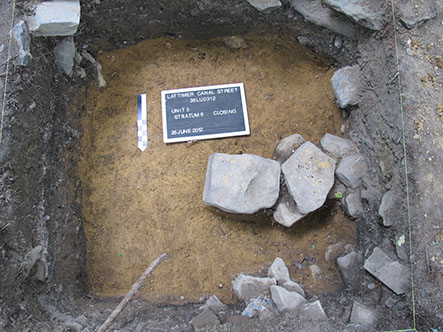
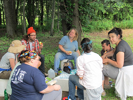
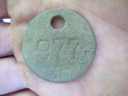
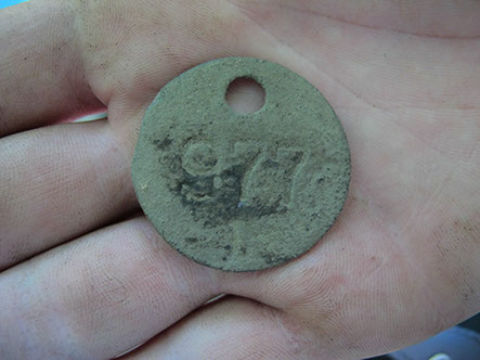
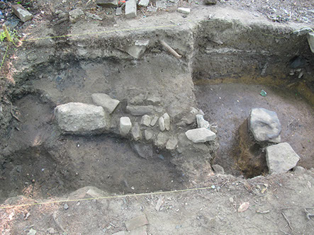
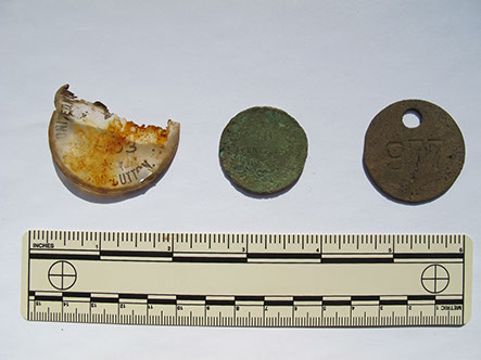
An archaeological field school began an initial survey of a house lot on Canal Street during the summer of 2012. A total of eleven full 5’x5’ units, two trenches and a half unit were excavated. In addition 31 shovel test pits were excavated on a 20’ grid with increments decreased to 10’ around the structure. We recovered over 10,000 artifacts from the site including architectural debris, bottles, ceramics, tools and personal items such as toys, jewelry, and keepsakes. The excavations revealed some of the different building methods employed to construct the house on the lot visible on the maps and aerial photographs. The main house was built on a stone pier made of slate. A great variety of nails reflect a long historical process of architectural modification, and possibly the scavenging and reusing of building materials. Other artifacts reflect the social and work life of the neighborhood including a miner’s check tag, a UMWA button (marked 1902) and an Italian coin dating to the 1870s.

1 - 17
<
>
Report
Maps
Sponsored by the University of Maryland Department of Anthropology
1111 Woods Hall, College Park, MD 20742
(c) 2015 V.C. Westmont
Contact us with feedback, questions, or concerns